Trail Walking Strasbourg - La ceinture verte de Strasbourg - Photo

La ceinture verte de Strasbourg

© OpenStreetMap contributors
Length
Length
19.8 km
Max alt
Max alt
155 m
Uphill gradient
Uphill gradient
197 m
Km-Effort
Km-Effort  
22 km
Min alt
Min alt
125 m
Downhill gradient
Downhill gradient
197 m
Boucle
Boucle
Yes
Creation date :
2024-05-20 08:19:16.539
Updated on :
2024-05-21 16:05:30.892

(0 Reviews)

Walking
Walking
4h06
Difficulty : Medium

Scan this QR Code to open this trail in the SityTrail application

FREE GPS app for hiking

Logo SityTrail SityTrail

IGN / Geographical institutes

Download SityTrail from the App Store Download SityTrail from Google Play

Logo SityTrail SityTrail World

The world is yours!

Download SityTrail from the App Store Download SityTrail from Google Play Download SityTrail on Huawei AppGallery

About

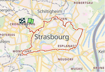
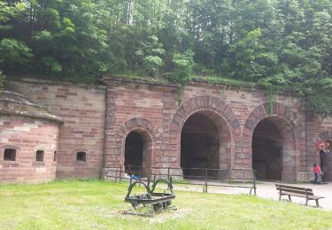
Trail Walking of 19.8 km to be discovered at Grand Est, Bas-Rhin, Strasbourg. This trail is proposed by VacheKiri67.

Description

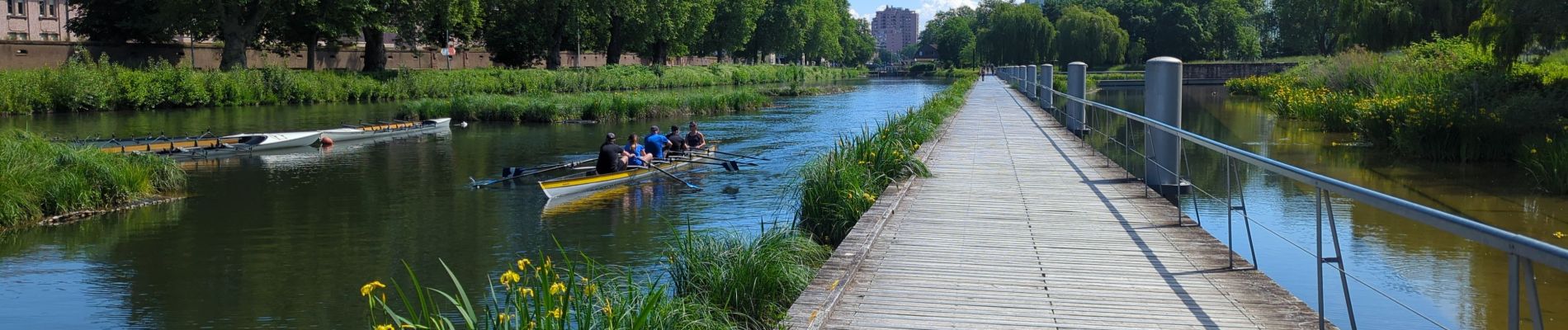
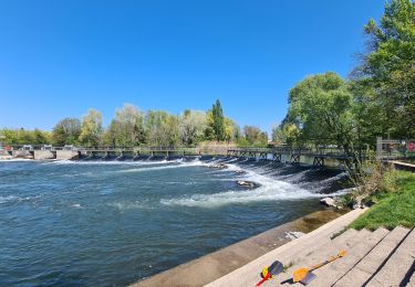
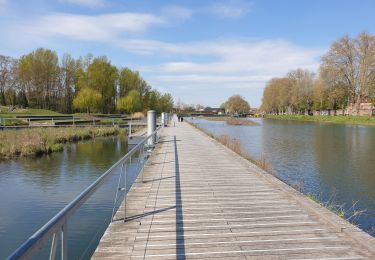
Faite le 20/05/2024. Ce sentier circulaire passe en milieu urbain et permet de découvrir un aspect insolite de Strasbourg en utilisant les espaces verts et les chemins longeant les voies d'eau. Balisage = anneau rouge.

Elevation profile

Photos

56 photos in total. Please click on a photo to see them all in the gallery.

Positioning

Country:
France
Region :
Grand Est
Department/Province :
Bas-Rhin
Municipality :
Strasbourg
Location:
Unknown
Start:(UTM)
405702 ; 5382890 (32U) N.

Trails nearby

Trail Walking Strasbourg - Strasbourg - Centre historique  - Photo
Walking
phil88

Walking

Easy
(3)
Strasbourg, Grand Est, Bas-Rhin, France
8 km | 9.2 km-effort
2h 11min
No
Trail Walking Strasbourg - Histoires d'eaux.... et de forêts au nord de Strasbourg - Photo
Walking
Claudele

Walking

Difficult
(1)
Strasbourg, Grand Est, Bas-Rhin, France
26 km | 28 km-effort
5h 57min
Yes
Trail Walking Strasbourg - Untitled - Photo
Walking
EricMathieu

Walking

Very easy
(1)
Strasbourg, Grand Est, Bas-Rhin, France
6.1 km | 7 km-effort
1h 42min
Yes
Trail Walking Bischheim - marchepop bischheim 10km 2021 - Photo
Walking
banitz

Walking

Very easy
(1)
Bischheim, Grand Est, Bas-Rhin, France
10.7 km | 11.8 km-effort
2h 31min
Yes
Trail Walking Strasbourg - 2022-08-25_07h47m05_Streckenplan Präsidentenwanderung über 15 km - Photo
Walking
Joseph Mertens

Walking

Medium
(2)
Strasbourg, Grand Est, Bas-Rhin, France
7 km | 8.4 km-effort
1h 53min
No
Trail Walking Strasbourg - La ceinture verte de Strasbourg - Photo
Walking
VacheKiri67

Walking

Difficult
Strasbourg, Grand Est, Bas-Rhin, France
20 km | 23 km-effort
3h 53min
Yes
Trail Walking Strasbourg - Forêt de la Robertsau et Rhin - Photo
Walking
Claudele

Walking

Easy
(1)
Strasbourg, Grand Est, Bas-Rhin, France
17.9 km | 20 km-effort
5h 13min
Yes
Trail Walking Strasbourg - Strasbourg Impérial  - Photo
Walking
phil88

Walking

Easy
Strasbourg, Grand Est, Bas-Rhin, France
11.6 km | 13.2 km-effort
3h 40min
Yes
Trail Walking Strasbourg - La ceinture verte de Strasbourg - Photo
Walking
VacheKiri67

Walking

Difficult
(1)
Strasbourg, Grand Est, Bas-Rhin, France
21 km | 23 km-effort
5h 21min
No


Close
My subscriptions