


Les Saintes - J1

David25400
User GUIDE
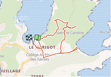

Length
3.3 km

Max alt
126 m

Uphill gradient
158 m
Km-Effort
5.5 km

Min alt
2 m

Downhill gradient
158 m
Boucle
Yes
Creation date :
2024-05-20 21:02:12.686
Updated on :
2024-05-20 22:52:01.777
1h49
Difficulty : Easy

FREE GPS app for hiking
 SityTrail
IGN / Geographical institutes
SityTrail Plus
The world is yours!
About
Trail Walking of 3.3 km to be discovered at Guadeloupe, Unknown, Terre-de-Haut. This trail is proposed by David25400.
Description
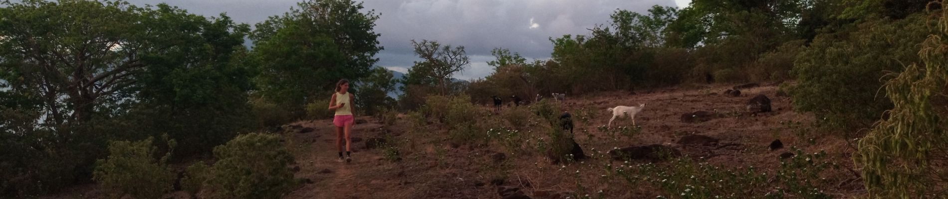
Baie de Pompierre - Morne Morel
Photos


Positioning
Country:
France
Region :
Guadeloupe
Department/Province :
Unknown
Municipality :
Terre-de-Haut
Location:
Unknown
Start:(Dec)
Start:(UTM)
652286 ; 1755398 (20P) N.
Comments