


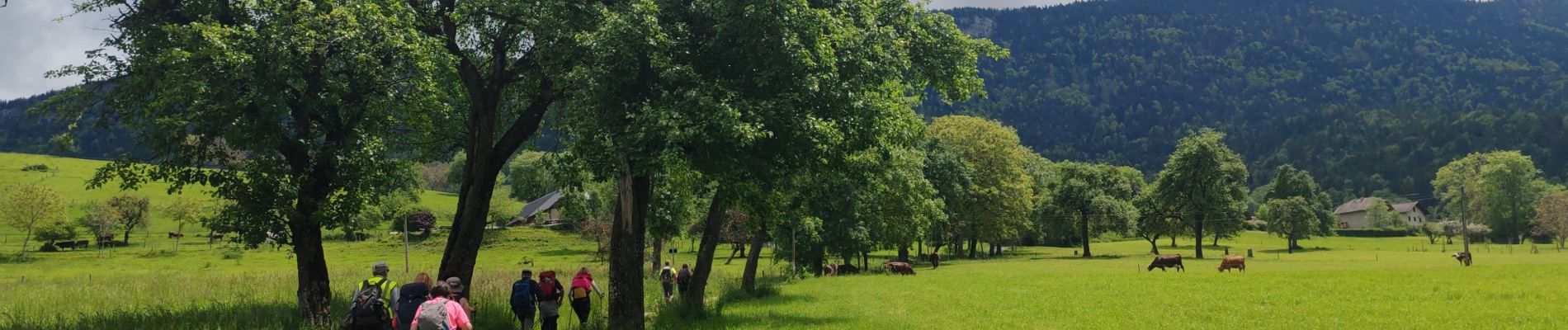
Annecy jour 5

Superpape
User
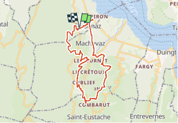

Length
18.1 km

Max alt
747 m

Uphill gradient
619 m
Km-Effort
26 km

Min alt
460 m

Downhill gradient
623 m
Boucle
Yes
Creation date :
2024-05-23 07:18:25.978
Updated on :
2024-05-23 14:09:41.237
6h12
Difficulty : Very difficult

FREE GPS app for hiking
 SityTrail
IGN / Geographical institutes
SityTrail Plus
The world is yours!
About
Trail Walking of 18.1 km to be discovered at Auvergne-Rhône-Alpes, Upper Savoy, Sevrier. This trail is proposed by Superpape.
Photos

Positioning
Country:
France
Region :
Auvergne-Rhône-Alpes
Department/Province :
Upper Savoy
Municipality :
Sevrier
Location:
Unknown
Start:(Dec)
Start:(UTM)
278039 ; 5080094 (32T) N.
Comments