


CAVALAIRE

Renefrt
User
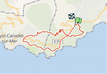

Length
9.2 km

Max alt
253 m

Uphill gradient
311 m
Km-Effort
13.4 km

Min alt
37 m

Downhill gradient
323 m
Boucle
No
Creation date :
2024-05-23 09:07:44.847
Updated on :
2024-05-23 14:22:17.592
5h13
Difficulty : Medium

FREE GPS app for hiking
 SityTrail
IGN / Geographical institutes
SityTrail Plus
The world is yours!
About
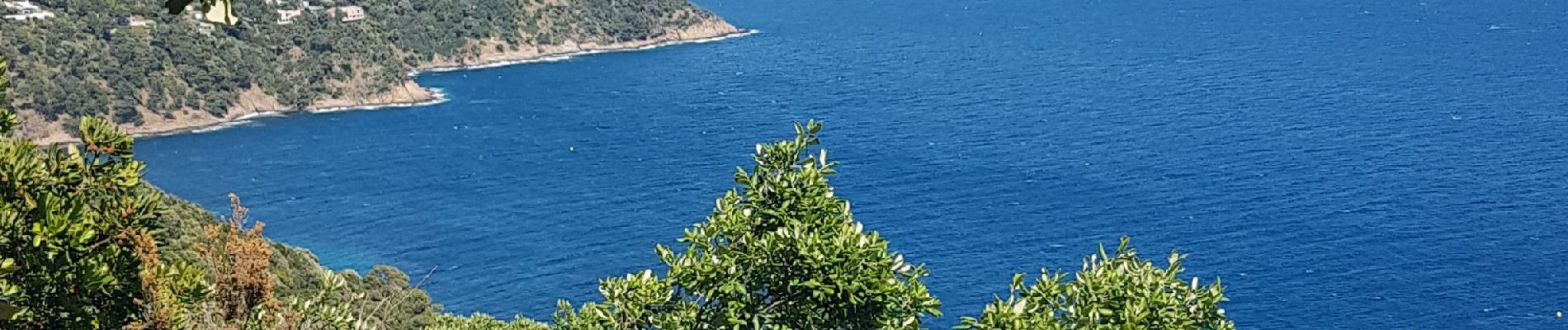
Trail Walking of 9.2 km to be discovered at Provence-Alpes-Côte d'Azur, Var, Cavalaire-sur-Mer. This trail is proposed by Renefrt.
Photos


Positioning
Country:
France
Region :
Provence-Alpes-Côte d'Azur
Department/Province :
Var
Municipality :
Cavalaire-sur-Mer
Location:
Unknown
Start:(Dec)
Start:(UTM)
297429 ; 4782039 (32T) N.
Comments