


2024-05-30-Andrésy

Rando MLC
User

Length
19.9 km

Max alt
174 m

Uphill gradient
424 m
Km-Effort
26 km

Min alt
17 m

Downhill gradient
425 m
Boucle
Yes
Creation date :
2024-05-24 07:52:32.355
Updated on :
2024-11-15 16:59:07.486
5h48
Difficulty : Very difficult

FREE GPS app for hiking
 SityTrail
IGN / Geographical institutes
SityTrail Plus
The world is yours!
About
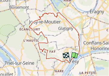
Trail Walking of 19.9 km to be discovered at Ile-de-France, Yvelines, Andrésy. This trail is proposed by Rando MLC.
Description
version longeant moins l'Oise
Positioning
Country:
France
Region :
Ile-de-France
Department/Province :
Yvelines
Municipality :
Andrésy
Location:
Unknown
Start:(Dec)
Start:(UTM)
431278 ; 5425815 (31U) N.
Comments