


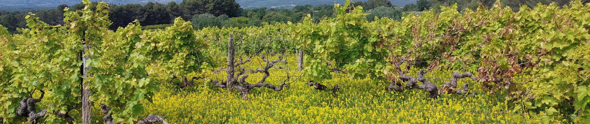
Entre Vignes et Cerises

supercolas
User GUIDE
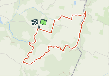

Length
5.5 km

Max alt
367 m

Uphill gradient
134 m
Km-Effort
7.3 km

Min alt
270 m

Downhill gradient
135 m
Boucle
Yes
Creation date :
2024-05-25 13:32:48.449
Updated on :
2024-05-26 10:50:28.532
1h30
Difficulty : Easy

FREE GPS app for hiking
 SityTrail
IGN / Geographical institutes
SityTrail Plus
The world is yours!
About
Trail Walking of 5.5 km to be discovered at Provence-Alpes-Côte d'Azur, Vaucluse, Mormoiron. This trail is proposed by supercolas.
Description
Mormoiron
Photos

Positioning
Country:
France
Region :
Provence-Alpes-Côte d'Azur
Department/Province :
Vaucluse
Municipality :
Mormoiron
Location:
Unknown
Start:(Dec)
Start:(UTM)
676723 ; 4881746 (31T) N.
Comments