


Villemoisson-sur-Orge Cyclisme sur route

Lucquiaud
User
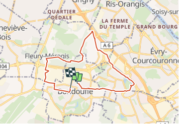

Length
14.2 km

Max alt
100 m

Uphill gradient
100 m
Km-Effort
15.5 km

Min alt
70 m

Downhill gradient
97 m
Boucle
No
Creation date :
2024-05-25 17:21:58.119
Updated on :
2024-05-25 17:28:38.77
1h04
Difficulty : Easy

FREE GPS app for hiking
 SityTrail
IGN / Geographical institutes
SityTrail Plus
The world is yours!
About
Trail Mountain bike of 14.2 km to be discovered at Ile-de-France, Essonne, Bondoufle. This trail is proposed by Lucquiaud.
Positioning
Country:
France
Region :
Ile-de-France
Department/Province :
Essonne
Municipality :
Bondoufle
Location:
Unknown
Start:(Dec)
Start:(UTM)
454101 ; 5384869 (31U) N.
Comments