


BenB 26/05/24 Richard

eaea7charles
User
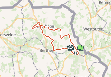

Length
12.1 km

Max alt
137 m

Uphill gradient
226 m
Km-Effort
15.1 km

Min alt
47 m

Downhill gradient
234 m
Boucle
Yes
Creation date :
2024-05-26 06:50:29.443
Updated on :
2024-05-26 10:10:23.766
2h40
Difficulty : Difficult

FREE GPS app for hiking
 SityTrail
IGN / Geographical institutes
SityTrail Plus
The world is yours!
About
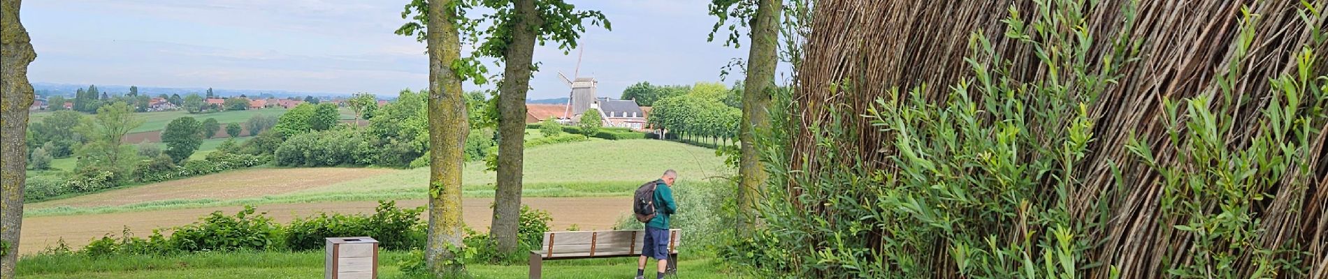
Trail Walking of 12.1 km to be discovered at Hauts-de-France, Nord, Saint-Jans-Cappel. This trail is proposed by eaea7charles.
Photos


Positioning
Country:
France
Region :
Hauts-de-France
Department/Province :
Nord
Municipality :
Saint-Jans-Cappel
Location:
Unknown
Start:(Dec)
Start:(UTM)
480799 ; 5625419 (31U) N.
Comments