


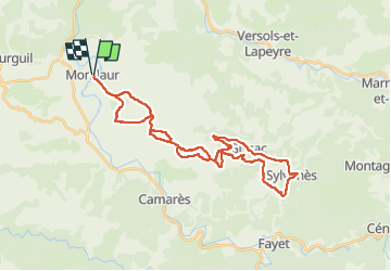
montlaur sylvanes

lablaquiere
User

Length
37 km

Max alt
632 m

Uphill gradient
707 m
Km-Effort
46 km

Min alt
340 m

Downhill gradient
707 m
Boucle
Yes
Creation date :
2024-05-26 06:37:51.151
Updated on :
2024-05-26 10:27:39.787
3h01
Difficulty : Very difficult

FREE GPS app for hiking
 SityTrail
IGN / Geographical institutes
SityTrail Plus
The world is yours!
About
Trail Mountain bike of 37 km to be discovered at Occitania, Aveyron, Montlaur. This trail is proposed by lablaquiere.
Positioning
Country:
France
Region :
Occitania
Department/Province :
Aveyron
Municipality :
Montlaur
Location:
Unknown
Start:(Dec)
Start:(UTM)
486713 ; 4858552 (31T) N.
Comments