


Saint André de Valborgne

Roger Philippe Wallez
User GUIDE
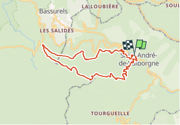

Length
17.9 km

Max alt
1101 m

Uphill gradient
711 m
Km-Effort
27 km

Min alt
441 m

Downhill gradient
716 m
Boucle
Yes
Creation date :
2024-05-26 07:33:23.0
Updated on :
2024-05-26 13:39:46.411
6h05
Difficulty : Very difficult

FREE GPS app for hiking
 SityTrail
IGN / Geographical institutes
SityTrail Plus
The world is yours!
About
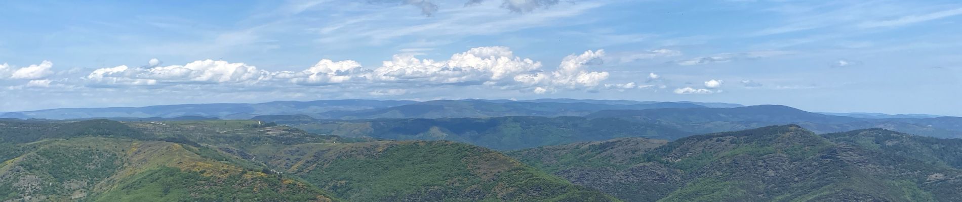
Trail Walking of 17.9 km to be discovered at Occitania, Gard, Saint-André-de-Valborgne. This trail is proposed by Roger Philippe Wallez.
Photos

Positioning
Country:
France
Region :
Occitania
Department/Province :
Gard
Municipality :
Saint-André-de-Valborgne
Location:
Unknown
Start:(Dec)
Start:(UTM)
554411 ; 4889558 (31T) N.
Comments