


Pic St Loup 20240525

cmike39
User
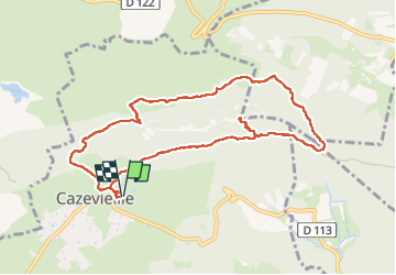

Length
10.5 km

Max alt
645 m

Uphill gradient
586 m
Km-Effort
18.3 km

Min alt
222 m

Downhill gradient
584 m
Boucle
Yes
Creation date :
2024-05-25 08:08:25.044
Updated on :
2024-05-27 07:36:05.001
3h52
Difficulty : Difficult

FREE GPS app for hiking
 SityTrail
IGN / Geographical institutes
SityTrail Plus
The world is yours!
About
Trail Walking of 10.5 km to be discovered at Occitania, Hérault, Cazevieille. This trail is proposed by cmike39.
Positioning
Country:
France
Region :
Occitania
Department/Province :
Hérault
Municipality :
Cazevieille
Location:
Unknown
Start:(Dec)
Start:(UTM)
563837 ; 4846657 (31T) N.
Comments