


jocou sans jocou

lionelnottat
User
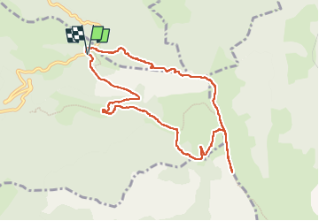

Length
10.2 km

Max alt
1881 m

Uphill gradient
652 m
Km-Effort
18.9 km

Min alt
1381 m

Downhill gradient
655 m
Boucle
Yes
Creation date :
2024-05-28 06:21:21.487
Updated on :
2024-05-28 12:45:34.635
3h38
Difficulty : Difficult

FREE GPS app for hiking
 SityTrail
IGN / Geographical institutes
SityTrail Plus
The world is yours!
About
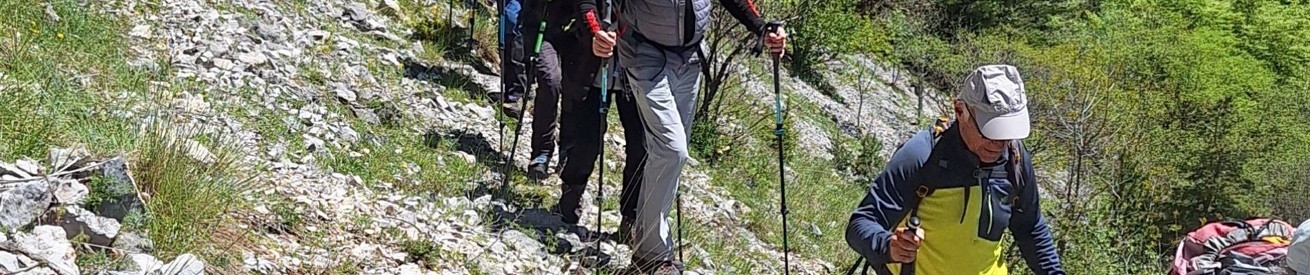
Trail Walking of 10.2 km to be discovered at Auvergne-Rhône-Alpes, Drôme, Châtillon-en-Diois. This trail is proposed by lionelnottat.
Photos


Positioning
Country:
France
Region :
Auvergne-Rhône-Alpes
Department/Province :
Drôme
Municipality :
Châtillon-en-Diois
Location:
Treschenu-Creyers
Start:(Dec)
Start:(UTM)
705962 ; 4959249 (31T) N.
Comments