


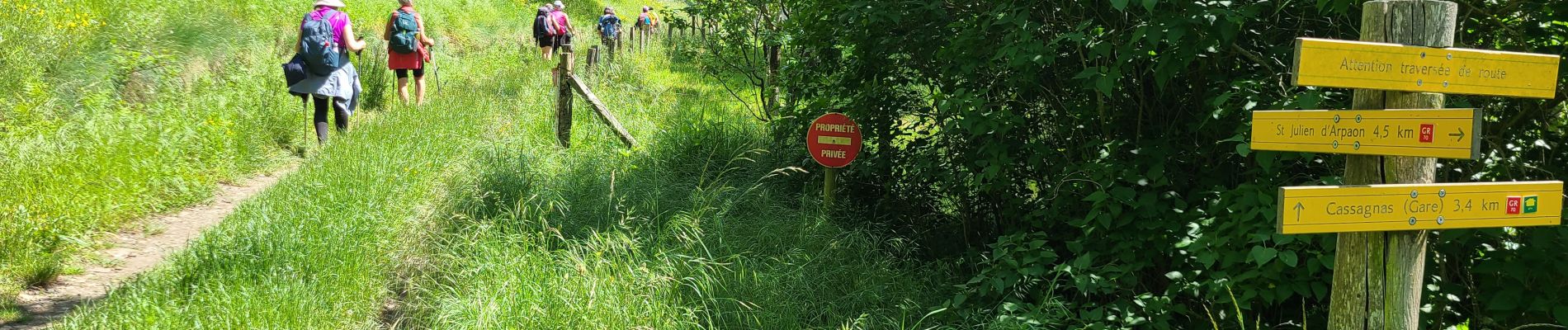
Stevenson Bédouès - Cassagnas

VANDERPUTTENMi
User GUIDE
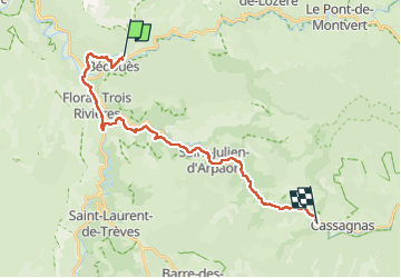

Length
24 km

Max alt
719 m

Uphill gradient
560 m
Km-Effort
31 km

Min alt
537 m

Downhill gradient
426 m
Boucle
No
Creation date :
2024-05-23 06:57:06.512
Updated on :
2024-05-29 17:05:27.381
5h56
Difficulty : Very difficult

FREE GPS app for hiking
 SityTrail
IGN / Geographical institutes
SityTrail Plus
The world is yours!
About
Trail Walking of 24 km to be discovered at Occitania, Lozère, Bédouès-Cocurès. This trail is proposed by VANDERPUTTENMi.
Photos

Positioning
Country:
France
Region :
Occitania
Department/Province :
Lozère
Municipality :
Bédouès-Cocurès
Location:
Bédouès
Start:(Dec)
Start:(UTM)
548720 ; 4910408 (31T) N.
Comments