


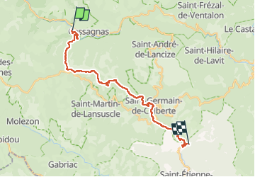
Stevenson Cassagnas - Pont de Burgen

VANDERPUTTENMi
User GUIDE

Length
24 km

Max alt
1034 m

Uphill gradient
550 m
Km-Effort
33 km

Min alt
271 m

Downhill gradient
970 m
Boucle
No
Creation date :
2024-05-24 06:56:48.171
Updated on :
2024-05-29 17:07:41.279
7h25
Difficulty : Very difficult

FREE GPS app for hiking
 SityTrail
IGN / Geographical institutes
SityTrail Plus
The world is yours!
About
Trail Walking of 24 km to be discovered at Occitania, Lozère, Cassagnas. This trail is proposed by VANDERPUTTENMi.
Photos

Positioning
Country:
France
Region :
Occitania
Department/Province :
Lozère
Municipality :
Cassagnas
Location:
Unknown
Start:(Dec)
Start:(UTM)
558294 ; 4902333 (31T) N.
Comments