


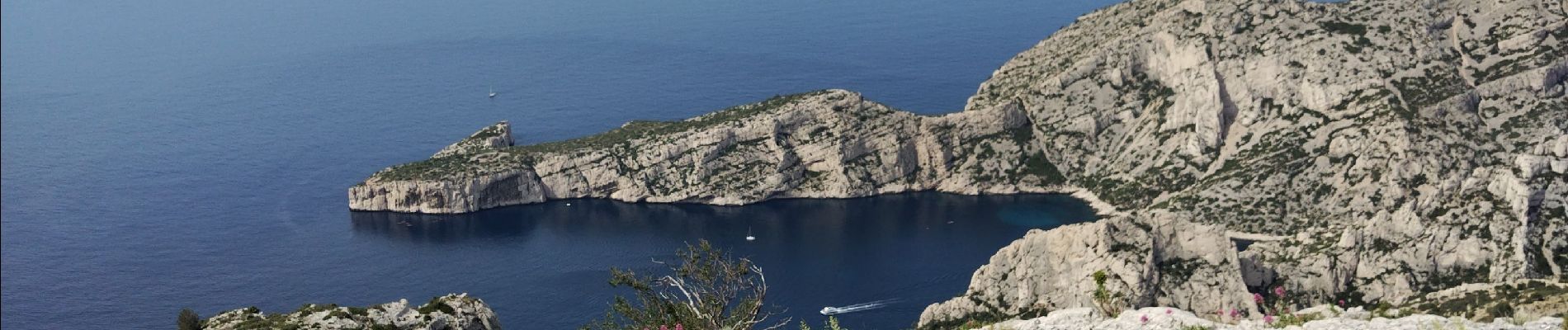
Mt Puget vallon Mestrallet

cousam
User
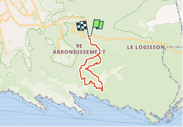

Length
11.3 km

Max alt
554 m

Uphill gradient
533 m
Km-Effort
18.5 km

Min alt
275 m

Downhill gradient
540 m
Boucle
Yes
Creation date :
2024-05-29 06:15:29.895
Updated on :
2024-05-29 17:10:16.36
5h50
Difficulty : Difficult

FREE GPS app for hiking
 SityTrail
IGN / Geographical institutes
SityTrail Plus
The world is yours!
About
Trail Walking of 11.3 km to be discovered at Provence-Alpes-Côte d'Azur, Bouches-du-Rhône, Marseille. This trail is proposed by cousam.
Photos


22 photos in total. Please click on a photo to see them all in the gallery.
Positioning
Country:
France
Region :
Provence-Alpes-Côte d'Azur
Department/Province :
Bouches-du-Rhône
Municipality :
Marseille
Location:
9th Arrondissement
Start:(Dec)
Start:(UTM)
699603 ; 4790443 (31T) N.
Comments