


J4G2

LouisROGER
User GUIDE
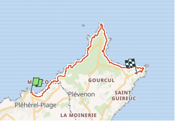

Length
12.8 km

Max alt
77 m

Uphill gradient
214 m
Km-Effort
15.6 km

Min alt
5 m

Downhill gradient
186 m
Boucle
No
Creation date :
2024-05-28 08:20:20.764
Updated on :
2024-05-29 13:20:07.452
5h37
Difficulty : Difficult

FREE GPS app for hiking
 SityTrail
IGN / Geographical institutes
SityTrail Plus
The world is yours!
About
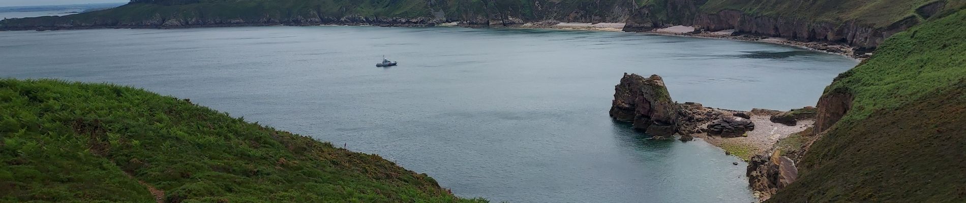
Trail Walking of 12.8 km to be discovered at Brittany, Côtes-d'Armor, Fréhel. This trail is proposed by LouisROGER.
Photos


Positioning
Country:
France
Region :
Brittany
Department/Province :
Côtes-d'Armor
Municipality :
Fréhel
Location:
Unknown
Start:(Dec)
Start:(UTM)
546592 ; 5389344 (30U) N.
Comments