


TET_F-01_20240501 Terminer1

olivieraron
User
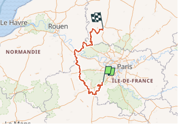

Length
319 km

Max alt
231 m

Uphill gradient
3380 m
Km-Effort
364 km

Min alt
10 m

Downhill gradient
3421 m
Boucle
No
Creation date :
2024-05-30 05:26:28.306
Updated on :
2024-05-30 05:38:39.323
5h00
Difficulty : Very easy

FREE GPS app for hiking
 SityTrail
IGN / Geographical institutes
SityTrail Plus
The world is yours!
About
Trail Moto cross of 319 km to be discovered at Ile-de-France, Essonne, Forges-les-Bains. This trail is proposed by olivieraron.
Positioning
Country:
France
Region :
Ile-de-France
Department/Province :
Essonne
Municipality :
Forges-les-Bains
Location:
Unknown
Start:(Dec)
Start:(UTM)
433788 ; 5386044 (31U) N.
Comments