


Col de La Pierre Levée - Col des Fosses - Crêtes de la Montagne du Liron - Col Lougares

vertygo
User
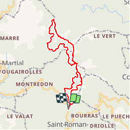

Length
15.5 km

Max alt
988 m

Uphill gradient
612 m
Km-Effort
24 km

Min alt
658 m

Downhill gradient
608 m
Boucle
Yes
Creation date :
2017-03-23 00:00:00.0
Updated on :
2017-03-23 00:00:00.0
5h28
Difficulty : Medium

FREE GPS app for hiking
 SityTrail
IGN / Geographical institutes
SityTrail Plus
The world is yours!
About
Trail Walking of 15.5 km to be discovered at Occitania, Gard, Saint-Roman-de-Codières. This trail is proposed by vertygo.
Positioning
Country:
France
Region :
Occitania
Department/Province :
Gard
Municipality :
Saint-Roman-de-Codières
Location:
Unknown
Start:(Dec)
Start:(UTM)
562442 ; 4873496 (31T) N.
Comments