


Marcinelles 27 05 24

andremusin
User
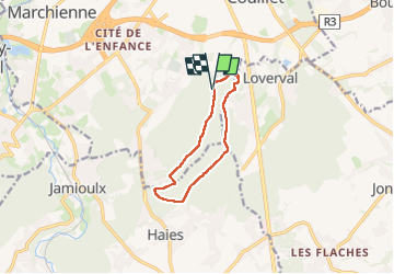

Length
8.3 km

Max alt
237 m

Uphill gradient
118 m
Km-Effort
9.8 km

Min alt
132 m

Downhill gradient
117 m
Boucle
Yes
Creation date :
2024-05-27 07:39:48.002
Updated on :
2024-06-01 12:00:39.771
1h35
Difficulty : Easy

FREE GPS app for hiking
 SityTrail
IGN / Geographical institutes
SityTrail Plus
The world is yours!
About
Trail Nordic walking of 8.3 km to be discovered at Wallonia, Hainaut, Charleroi. This trail is proposed by andremusin.
Positioning
Country:
Belgium
Region :
Wallonia
Department/Province :
Hainaut
Municipality :
Charleroi
Location:
Unknown
Start:(Dec)
Start:(UTM)
603492 ; 5581087 (31U) N.
Comments