


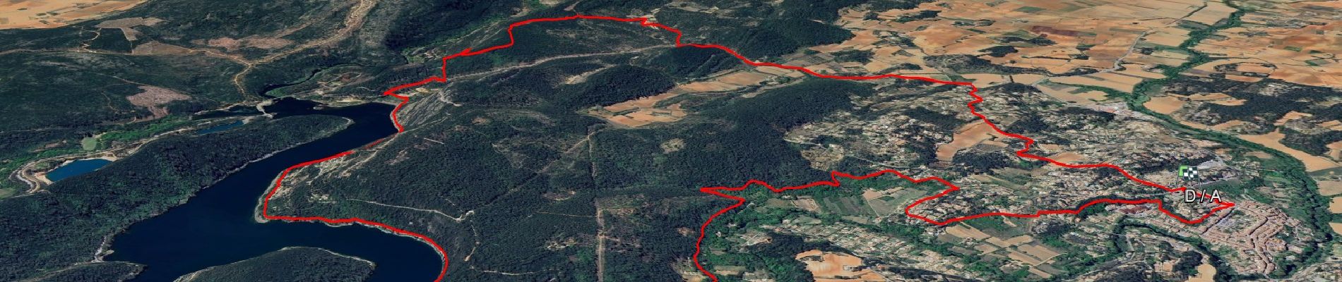
SityTrail - Cimetière - GR 51 - Les Plaines - Bord du lac - Canal d'irrigation

affinetataille
User GUIDE

Length
15.6 km

Max alt
307 m

Uphill gradient
332 m
Km-Effort
20 km

Min alt
140 m

Downhill gradient
332 m
Boucle
Yes
Creation date :
2024-06-01 12:54:44.362
Updated on :
2024-06-07 16:08:32.341
6h00
Difficulty : Medium

FREE GPS app for hiking
 SityTrail
IGN / Geographical institutes
SityTrail Plus
The world is yours!
About
Trail Walking of 15.6 km to be discovered at Provence-Alpes-Côte d'Azur, Var, Carcès. This trail is proposed by affinetataille.
Photos


36 photos in total. Please click on a photo to see them all in the gallery.
Positioning
Country:
France
Region :
Provence-Alpes-Côte d'Azur
Department/Province :
Var
Municipality :
Carcès
Location:
Unknown
Start:(Dec)
Start:(UTM)
272147 ; 4817497 (32T) N.
Comments