


Col de l’Egue

lebarça
User
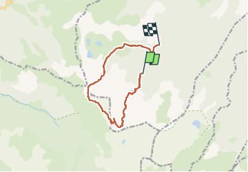

Length
11.5 km

Max alt
2169 m

Uphill gradient
612 m
Km-Effort
20 km

Min alt
1591 m

Downhill gradient
706 m
Boucle
No
Creation date :
2024-06-01 09:01:13.0
Updated on :
2024-06-02 07:53:40.159

FREE GPS app for hiking
 SityTrail
IGN / Geographical institutes
SityTrail Plus
The world is yours!
About
Trail of 11.5 km to be discovered at Occitania, Ariège, Mijanès. This trail is proposed by lebarça.
Positioning
Country:
France
Region :
Occitania
Department/Province :
Ariège
Municipality :
Mijanès
Location:
Unknown
Start:(Dec)
Start:(UTM)
417923 ; 4727152 (31T) N.
Comments