


Savonnières - Zig zag Villandry - 20.7km 260m 4h25 (40mn) - 2024 06 02

Orcal37
User GUIDE
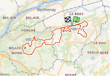

Length
21 km

Max alt
94 m

Uphill gradient
259 m
Km-Effort
24 km

Min alt
40 m

Downhill gradient
261 m
Boucle
Yes
Creation date :
2024-06-02 09:51:21.669
Updated on :
2024-06-02 17:37:28.877
4h25
Difficulty : Easy

FREE GPS app for hiking
 SityTrail
IGN / Geographical institutes
SityTrail Plus
The world is yours!
About
Trail Walking of 21 km to be discovered at Centre-Loire Valley, Indre-et-Loire, Savonnières. This trail is proposed by Orcal37.
Description
Savonnières - Zig zag - Villandry - 20.7km 260m 4h25 (40mn) - 2024 06 02
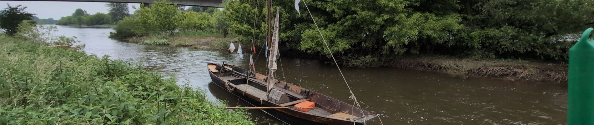
Photos
 - 2024 06 02 - Photo 1")
 - 2024 06 02 - Photo 2")
 - 2024 06 02 - Photo 3")
 - 2024 06 02 - Photo 4")
 - 2024 06 02 - Photo 5")
 - 2024 06 02 - Photo 6")
 - 2024 06 02 - Photo 7")
 - 2024 06 02 - Photo 8")
 - 2024 06 02 - Photo 9")
Positioning
Country:
France
Region :
Centre-Loire Valley
Department/Province :
Indre-et-Loire
Municipality :
Savonnières
Location:
Unknown
Start:(Dec)
Start:(UTM)
315252 ; 5246855 (31T) N.
Comments