


saint Rome du Tarn

tosan
User
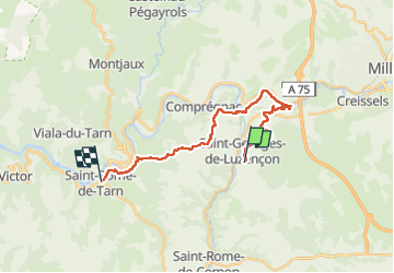

Length
22 km

Max alt
552 m

Uphill gradient
564 m
Km-Effort
30 km

Min alt
337 m

Downhill gradient
562 m
Boucle
No
Creation date :
2024-06-03 06:41:50.179
Updated on :
2024-06-03 14:50:06.834
8h07
Difficulty : Very difficult

FREE GPS app for hiking
 SityTrail
IGN / Geographical institutes
SityTrail Plus
The world is yours!
About
Trail Walking of 22 km to be discovered at Occitania, Aveyron, Saint-Georges-de-Luzençon. This trail is proposed by tosan.
Positioning
Country:
France
Region :
Occitania
Department/Province :
Aveyron
Municipality :
Saint-Georges-de-Luzençon
Location:
Unknown
Start:(Dec)
Start:(UTM)
498962 ; 4878296 (31T) N.
Comments