


2024-06-03

rando30129
User
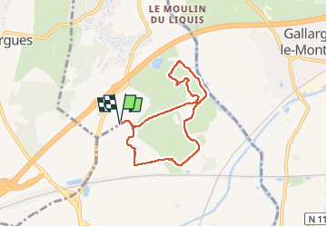

Length
6.6 km

Max alt
49 m

Uphill gradient
84 m
Km-Effort
7.8 km

Min alt
14 m

Downhill gradient
84 m
Boucle
Yes
Creation date :
2024-06-04 12:07:26.938
Updated on :
2024-06-04 14:40:23.515
2h31
Difficulty : Medium

FREE GPS app for hiking
 SityTrail
IGN / Geographical institutes
SityTrail Plus
The world is yours!
About
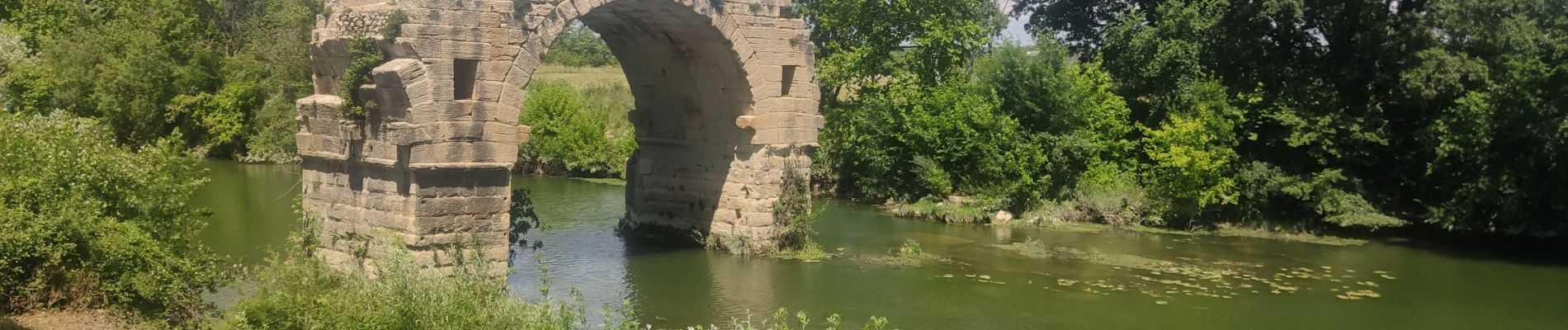
Trail Walking of 6.6 km to be discovered at Occitania, Hérault, Villetelle. This trail is proposed by rando30129.
Photos


Positioning
Country:
France
Region :
Occitania
Department/Province :
Hérault
Municipality :
Villetelle
Location:
Unknown
Start:(Dec)
Start:(UTM)
591580 ; 4840386 (31T) N.
Comments