


Lure 15kms 830m

Danielba
User GUIDE
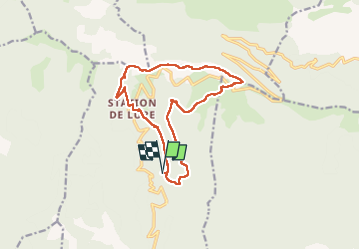

Length
14.8 km

Max alt
1823 m

Uphill gradient
743 m
Km-Effort
25 km

Min alt
1246 m

Downhill gradient
743 m
Boucle
Yes
Creation date :
2024-06-04 06:48:53.703
Updated on :
2024-06-04 16:19:41.942
6h55
Difficulty : Easy

FREE GPS app for hiking
 SityTrail
IGN / Geographical institutes
SityTrail Plus
The world is yours!
About
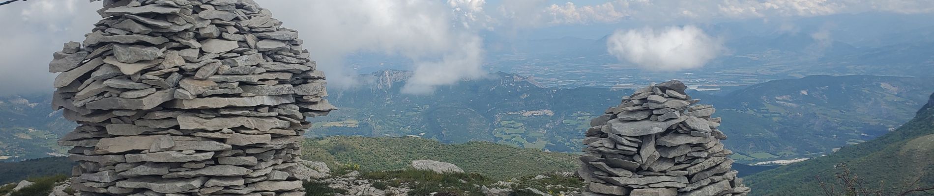
Trail Walking of 14.8 km to be discovered at Provence-Alpes-Côte d'Azur, Alpes-de-Haute-Provence, Saint-Étienne-les-Orgues. This trail is proposed by Danielba .
Photos


Positioning
Country:
France
Region :
Provence-Alpes-Côte d'Azur
Department/Province :
Alpes-de-Haute-Provence
Municipality :
Saint-Étienne-les-Orgues
Location:
Unknown
Start:(Dec)
Start:(UTM)
723451 ; 4886455 (31T) N.
Comments