


Raccourci

ophness
User
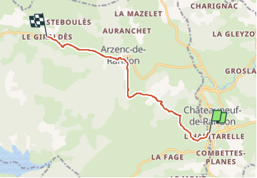

Length
9.3 km

Max alt
1293 m

Uphill gradient
265 m
Km-Effort
12.5 km

Min alt
1174 m

Downhill gradient
166 m
Boucle
No
Creation date :
2024-06-06 09:01:11.0
Updated on :
2024-06-06 09:01:20.681

FREE GPS app for hiking
 SityTrail
IGN / Geographical institutes
SityTrail Plus
The world is yours!
About
Trail of 9.3 km to be discovered at Occitania, Lozère, Châteauneuf-de-Randon. This trail is proposed by ophness.
Positioning
Country:
France
Region :
Occitania
Department/Province :
Lozère
Municipality :
Châteauneuf-de-Randon
Location:
Unknown
Start:(Dec)
Start:(UTM)
553457 ; 4942608 (31T) N.
Comments