


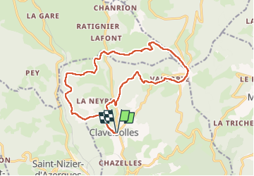
Claveisolles (17 km - D. 645 m)

Thomasdanielle
User

Length
17 km

Max alt
827 m

Uphill gradient
648 m
Km-Effort
26 km

Min alt
447 m

Downhill gradient
647 m
Boucle
Yes
Creation date :
2024-06-06 07:07:15.0
Updated on :
2024-06-11 06:14:36.307
5h50
Difficulty : Very difficult

FREE GPS app for hiking
 SityTrail
IGN / Geographical institutes
SityTrail Plus
The world is yours!
About
Trail Walking of 17 km to be discovered at Auvergne-Rhône-Alpes, Rhône, Claveisolles. This trail is proposed by Thomasdanielle.
Description
D/A : Parking le bourg "salle polyvalente"
Positioning
Country:
France
Region :
Auvergne-Rhône-Alpes
Department/Province :
Rhône
Municipality :
Claveisolles
Location:
Unknown
Start:(Dec)
Start:(UTM)
615591 ; 5106265 (31T) N.
Comments