


0706

maxEA65
User
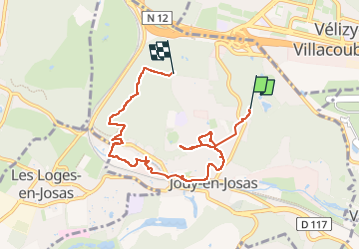

Length
7.2 km

Max alt
183 m

Uphill gradient
145 m
Km-Effort
9 km

Min alt
87 m

Downhill gradient
122 m
Boucle
No
Creation date :
2024-06-07 07:03:42.166
Updated on :
2024-06-07 08:59:28.14
1h55
Difficulty : Medium

FREE GPS app for hiking
 SityTrail
IGN / Geographical institutes
SityTrail Plus
The world is yours!
About
Trail Walking of 7.2 km to be discovered at Ile-de-France, Yvelines, Jouy-en-Josas. This trail is proposed by maxEA65.
Positioning
Country:
France
Region :
Ile-de-France
Department/Province :
Yvelines
Municipality :
Jouy-en-Josas
Location:
Unknown
Start:(Dec)
Start:(UTM)
439370 ; 5402552 (31U) N.
Comments