


Chemin cathare Montgaillard etap6

taguette
User
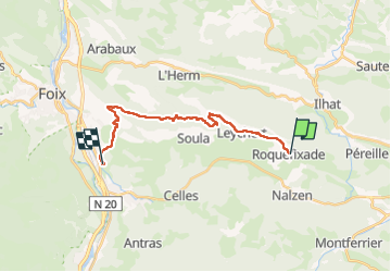

Length
17.8 km

Max alt
933 m

Uphill gradient
531 m
Km-Effort
26 km

Min alt
439 m

Downhill gradient
854 m
Boucle
No
Creation date :
2024-06-07 06:23:25.148
Updated on :
2024-06-07 12:59:53.523
4h35
Difficulty : Very difficult

FREE GPS app for hiking
 SityTrail
IGN / Geographical institutes
SityTrail Plus
The world is yours!
About
Trail Walking of 17.8 km to be discovered at Occitania, Ariège, Roquefixade. This trail is proposed by taguette.
Positioning
Country:
France
Region :
Occitania
Department/Province :
Ariège
Municipality :
Roquefixade
Location:
Unknown
Start:(Dec)
Start:(UTM)
398529 ; 4754444 (31T) N.
Comments