


Asnelles sur mer-Ver sur mer (Calvados)

ISATR
User
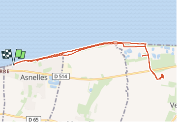

Length
10.1 km

Max alt
40 m

Uphill gradient
59 m
Km-Effort
10.9 km

Min alt
-1 m

Downhill gradient
59 m
Boucle
Yes
Creation date :
2024-06-09 06:43:26.37
Updated on :
2024-07-10 10:19:38.195
3h45
Difficulty : Easy

FREE GPS app for hiking
 SityTrail
IGN / Geographical institutes
SityTrail Plus
The world is yours!
About
Trail Walking of 10.1 km to be discovered at Normandy, Calvados, Asnelles. This trail is proposed by ISATR.
Description
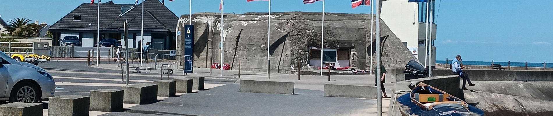
Plage du débarquement. Mémorial Britannique.
Photos
 - Photo 1")
 - Photo 2")
 - Photo 3")
 - Photo 4")
 - Photo 5")
 - Photo 6")
 - Photo 7")
 - Photo 8")
 - Photo 9")
Positioning
Country:
France
Region :
Normandy
Department/Province :
Calvados
Municipality :
Asnelles
Location:
Unknown
Start:(Dec)
Start:(UTM)
675072 ; 5468171 (30U) N.
Comments