Trail Walking Le Castellet - Roche Redonne depuis Ste Anne du Castelet - Photo

Roche Redonne depuis Ste Anne du Castelet

© OpenStreetMap contributors
Length
Length
11 km
Max alt
Max alt
429 m
Uphill gradient
Uphill gradient
359 m
Km-Effort
Km-Effort  
15.7 km
Min alt
Min alt
186 m
Downhill gradient
Downhill gradient
355 m
Boucle
Boucle
Yes
Creation date :
2024-06-09 07:28:14.1
Updated on :
2024-06-09 17:38:47.097

(2 Reviews)

Walking
Walking
3h34
Difficulty : Difficult

Scan this QR Code to open this trail in the SityTrail application

FREE GPS app for hiking

Logo SityTrail SityTrail

IGN / Geographical institutes

Download SityTrail from the App Store Download SityTrail from Google Play

Logo SityTrail SityTrail Plus

The world is yours!

Download SityTrail from the App Store Download SityTrail from Google Play Download SityTrail on Huawei AppGallery

About

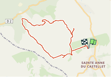
Trail Walking of 11 km to be discovered at Provence-Alpes-Côte d'Azur, Var, Le Castellet. This trail is proposed by Daniel.BRUN-PICARD.

Description

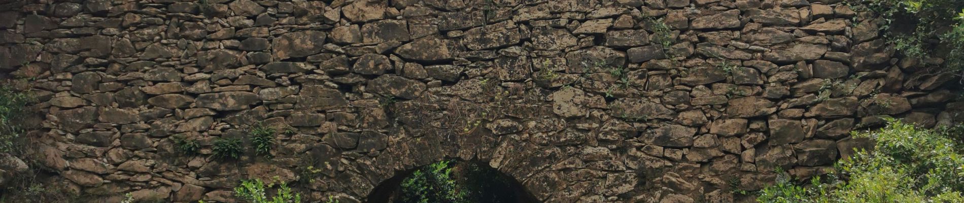
Belle randonnée menée par le Touring Club du Var. Les chemins sont caillouteux et il y a une montée très raide sur une bonne centaine de mètres. Bonnes chaussures de randonnée indispensables et bâtons recommandés. Outre la roche Redonne impressionnante, ou découvre une source à sec en cette saison, un four à chaux, un four à poix et un beau pont romain. Un grand merci à notre animatrice.

Elevation profile

Photos

Positioning

Country:
France
Region :
Provence-Alpes-Côte d'Azur
Department/Province :
Var
Municipality :
Le Castellet
Location:
Unknown
Start:(UTM)
724303 ; 4790358 (31T) N.

Comments

Please log in to post a review or rate the element


belle rando. merci


Close
My subscriptions