


9_6_24

baudon
User
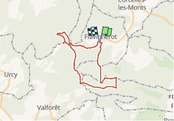

Length
14.6 km

Max alt
571 m

Uphill gradient
396 m
Km-Effort
19.9 km

Min alt
392 m

Downhill gradient
393 m
Boucle
Yes
Creation date :
2024-06-09 07:23:59.078
Updated on :
2024-06-09 18:09:37.084
8h58
Difficulty : Very difficult

FREE GPS app for hiking
 SityTrail
IGN / Geographical institutes
SityTrail Plus
The world is yours!
About
Trail Walking of 14.6 km to be discovered at Bourgogne-Franche-Comté, Côte-d'Or, Flavignerot. This trail is proposed by baudon.
Positioning
Country:
France
Region :
Bourgogne-Franche-Comté
Department/Province :
Côte-d'Or
Municipality :
Flavignerot
Location:
Unknown
Start:(Dec)
Start:(UTM)
645036 ; 5237657 (31T) N.
Comments