


Ortiz

jouans
User GUIDE
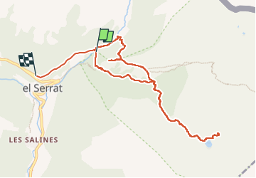

Length
11 km

Max alt
2424 m

Uphill gradient
762 m
Km-Effort
21 km

Min alt
1694 m

Downhill gradient
850 m
Boucle
No
Creation date :
2024-06-11 07:26:02.0
Updated on :
2024-06-11 13:24:58.051

FREE GPS app for hiking
 SityTrail
IGN / Geographical institutes
SityTrail Plus
The world is yours!
About
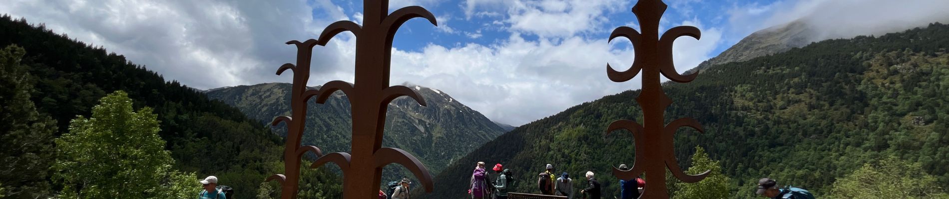
Trail of 11 km to be discovered at Andorra. This trail is proposed by jouans.
Photos


Positioning
Country:
Andorra
Region :
Unknown
Department/Province :
Unknown
Municipality :
Unknown
Location:
Unknown
Start:(Dec)
Start:(UTM)
381253 ; 4720300 (31T) N.
Comments