


Tour du mont Aiguille de Trézane à la Richardière

chasle
User
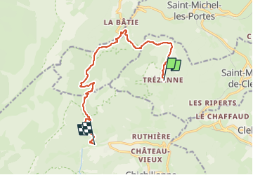

Length
12.1 km

Max alt
1708 m

Uphill gradient
932 m
Km-Effort
24 km

Min alt
1019 m

Downhill gradient
892 m
Boucle
No
Creation date :
2024-06-12 15:52:41.562
Updated on :
2024-06-15 07:48:25.269
5h32
Difficulty : Difficult

FREE GPS app for hiking
 SityTrail
IGN / Geographical institutes
SityTrail Plus
The world is yours!
About
Trail Walking of 12.1 km to be discovered at Auvergne-Rhône-Alpes, Isère, Saint-Martin-de-Clelles. This trail is proposed by chasle.
Positioning
Country:
France
Region :
Auvergne-Rhône-Alpes
Department/Province :
Isère
Municipality :
Saint-Martin-de-Clelles
Location:
Unknown
Start:(Dec)
Start:(UTM)
703901 ; 4968931 (31T) N.
Comments