


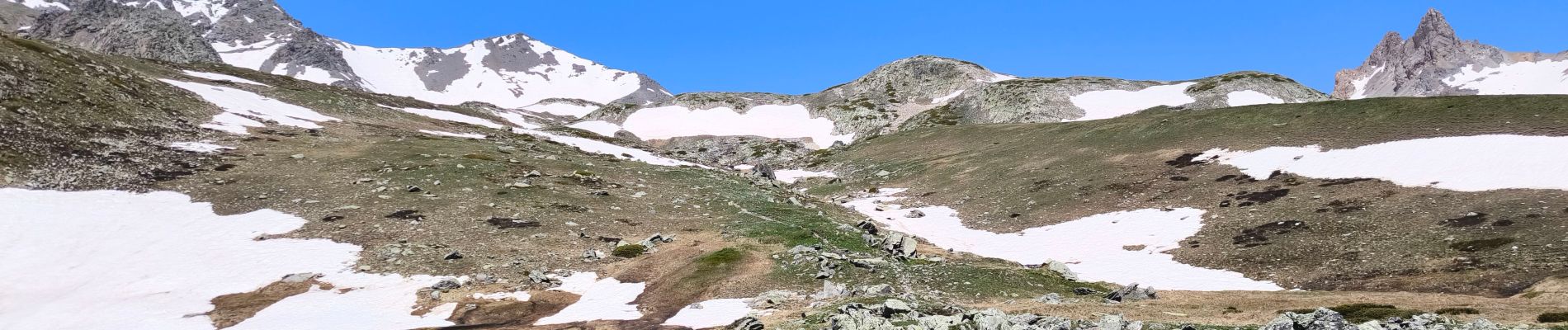
Col du Vallon NEVACHE

tyntyn
User
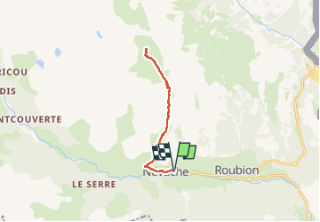

Length
11.4 km

Max alt
2335 m

Uphill gradient
733 m
Km-Effort
21 km

Min alt
1595 m

Downhill gradient
734 m
Boucle
Yes
Creation date :
2024-06-13 07:17:16.139
Updated on :
2024-06-13 14:43:40.681
5h08
Difficulty : Very difficult

FREE GPS app for hiking
 SityTrail
IGN / Geographical institutes
SityTrail Plus
The world is yours!
About
Trail Walking of 11.4 km to be discovered at Provence-Alpes-Côte d'Azur, Hautes-Alpes, Névache. This trail is proposed by tyntyn.
Photos


Positioning
Country:
France
Region :
Provence-Alpes-Côte d'Azur
Department/Province :
Hautes-Alpes
Municipality :
Névache
Location:
Unknown
Start:(Dec)
Start:(UTM)
311500 ; 4987853 (32T) N.
Comments