


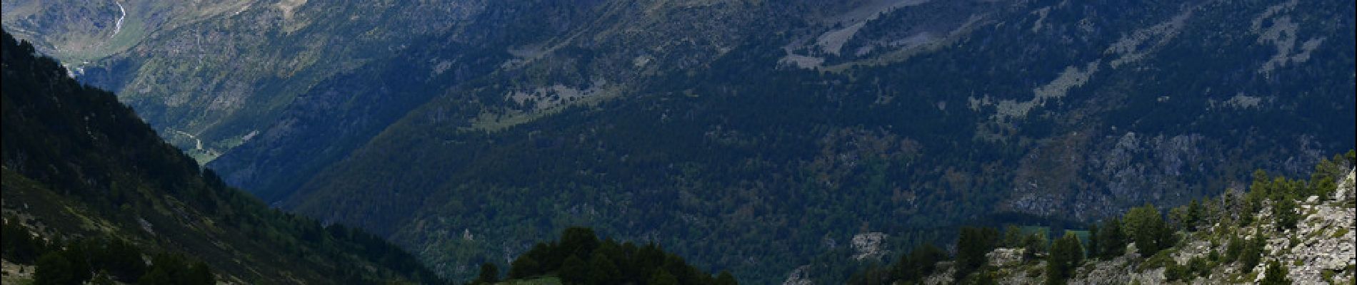
Lac Estany de l'Estanyo

LtZIP
User
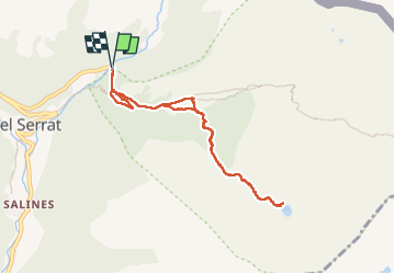

Length
8.4 km

Max alt
2344 m

Uphill gradient
579 m
Km-Effort
16.1 km

Min alt
1788 m

Downhill gradient
579 m
Boucle
Yes
Creation date :
2024-06-11 07:21:01.618
Updated on :
2024-06-25 07:35:24.267
3h06
Difficulty : Medium

FREE GPS app for hiking
 SityTrail
IGN / Geographical institutes
SityTrail Plus
The world is yours!
About
Trail Walking of 8.4 km to be discovered at Andorra. This trail is proposed by LtZIP.
Description
IBP
Rouge 87
Photos


Positioning
Country:
Andorra
Region :
Unknown
Department/Province :
Unknown
Municipality :
Unknown
Location:
Unknown
Start:(Dec)
Start:(UTM)
381244 ; 4720300 (31T) N.
Comments