


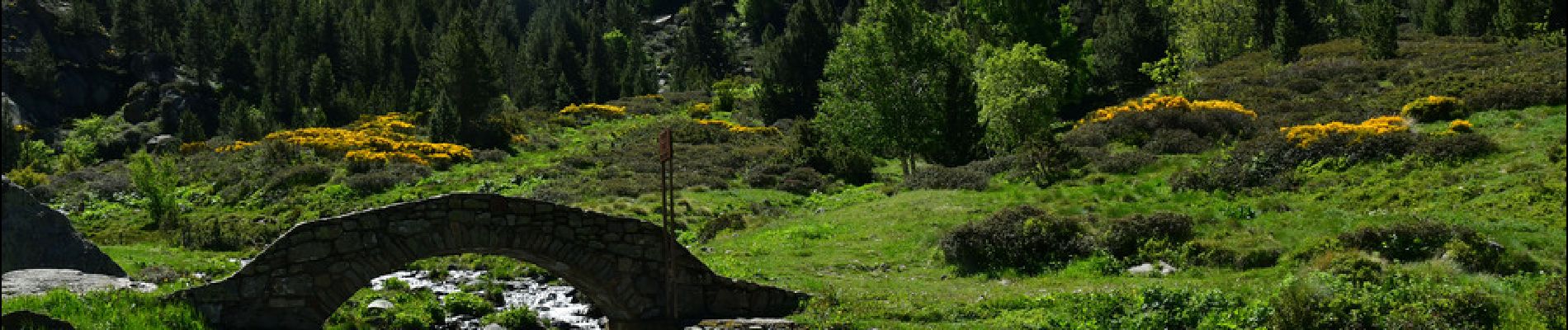
Cascade de Juclar

LtZIP
User
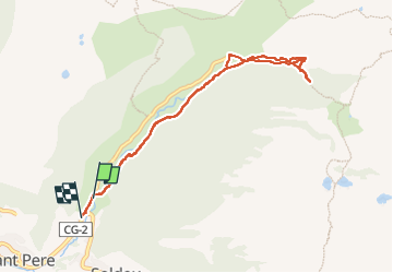

Length
9.2 km

Max alt
2006 m

Uphill gradient
330 m
Km-Effort
13.6 km

Min alt
1752 m

Downhill gradient
335 m
Boucle
No
Creation date :
2024-06-13 07:34:01.271
Updated on :
2024-06-25 07:43:49.073
3h06
Difficulty : Easy

FREE GPS app for hiking
 SityTrail
IGN / Geographical institutes
SityTrail Plus
The world is yours!
About
Trail Walking of 9.2 km to be discovered at Andorra. This trail is proposed by LtZIP.
Description
IBP
Bleu 50
Photos


Positioning
Country:
Andorra
Region :
Unknown
Department/Province :
Unknown
Municipality :
Unknown
Location:
Unknown
Start:(Dec)
Start:(UTM)
390434 ; 4715666 (31T) N.
Comments