


Hinterzarten - Titisee

Bart2015
User
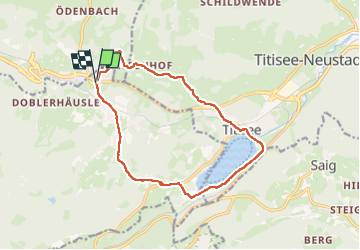

Length
13.5 km

Max alt
973 m

Uphill gradient
283 m
Km-Effort
17.3 km

Min alt
845 m

Downhill gradient
284 m
Boucle
Yes
Creation date :
2024-06-15 08:27:25.833
Updated on :
2024-06-17 15:24:29.106
3h55
Difficulty : Difficult

FREE GPS app for hiking
 SityTrail
IGN / Geographical institutes
SityTrail Plus
The world is yours!
About
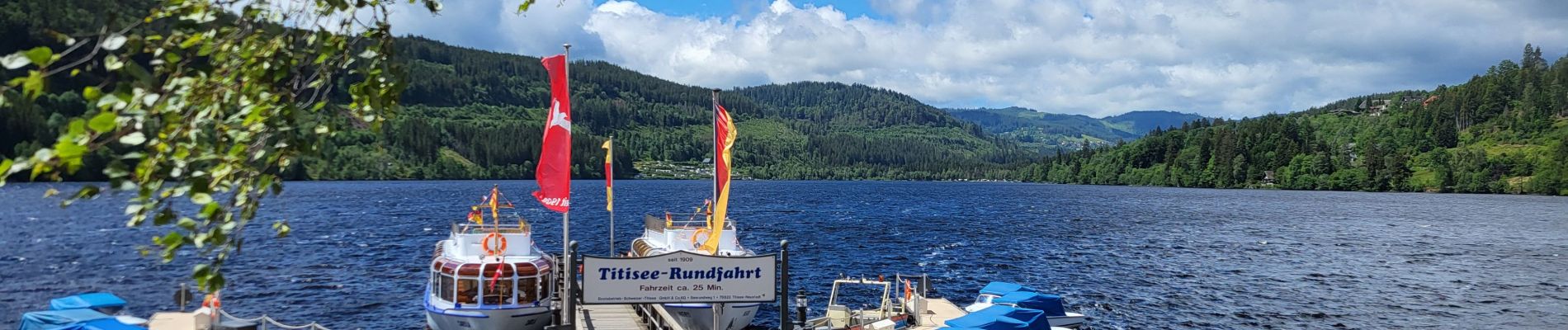
Trail Walking of 13.5 km to be discovered at Baden-Württemberg, Landkreis Breisgau-Hochschwarzwald, Hinterzarten. This trail is proposed by Bart2015.
Photos


Positioning
Country:
Germany
Region :
Baden-Württemberg
Department/Province :
Landkreis Breisgau-Hochschwarzwald
Municipality :
Hinterzarten
Location:
Unknown
Start:(Dec)
Start:(UTM)
432758 ; 5306916 (32T) N.
Comments