


st Vincent la commanderie

collot
User
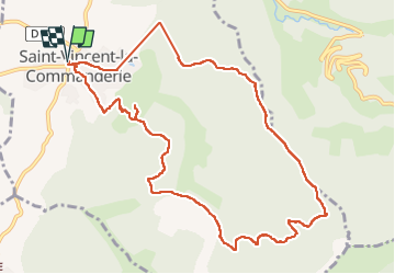

Length
12.2 km

Max alt
813 m

Uphill gradient
566 m
Km-Effort
19.7 km

Min alt
373 m

Downhill gradient
566 m
Boucle
Yes
Creation date :
2024-06-16 07:45:03.91
Updated on :
2024-06-16 14:20:46.705
6h34
Difficulty : Medium

FREE GPS app for hiking
 SityTrail
IGN / Geographical institutes
SityTrail Plus
The world is yours!
About
Trail Walking of 12.2 km to be discovered at Auvergne-Rhône-Alpes, Drôme, Saint-Vincent-la-Commanderie. This trail is proposed by collot.
Positioning
Country:
France
Region :
Auvergne-Rhône-Alpes
Department/Province :
Drôme
Municipality :
Saint-Vincent-la-Commanderie
Location:
Unknown
Start:(Dec)
Start:(UTM)
666964 ; 4978340 (31T) N.
Comments