


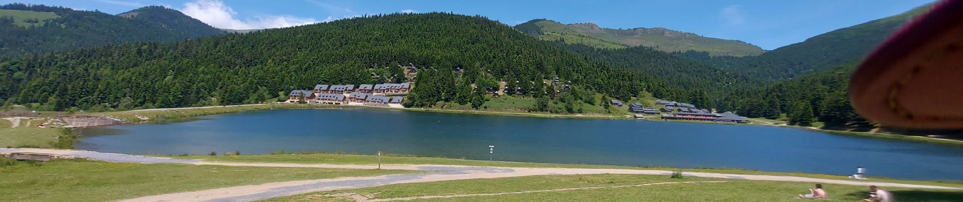
20240617 Lac de Payolles

Childebert
User
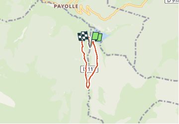

Length
3.9 km

Max alt
1290 m

Uphill gradient
151 m
Km-Effort
5.9 km

Min alt
1134 m

Downhill gradient
153 m
Boucle
Yes
Creation date :
2024-06-17 12:23:03.4
Updated on :
2024-06-17 15:00:27.367
1h44
Difficulty : Medium

FREE GPS app for hiking
 SityTrail
IGN / Geographical institutes
SityTrail Plus
The world is yours!
About
Trail Walking of 3.9 km to be discovered at Occitania, Hautespyrenees, Arreau. This trail is proposed by Childebert.
Photos


Positioning
Country:
France
Region :
Occitania
Department/Province :
Hautespyrenees
Municipality :
Arreau
Location:
Unknown
Start:(Dec)
Start:(UTM)
279155 ; 4756812 (31T) N.
Comments