


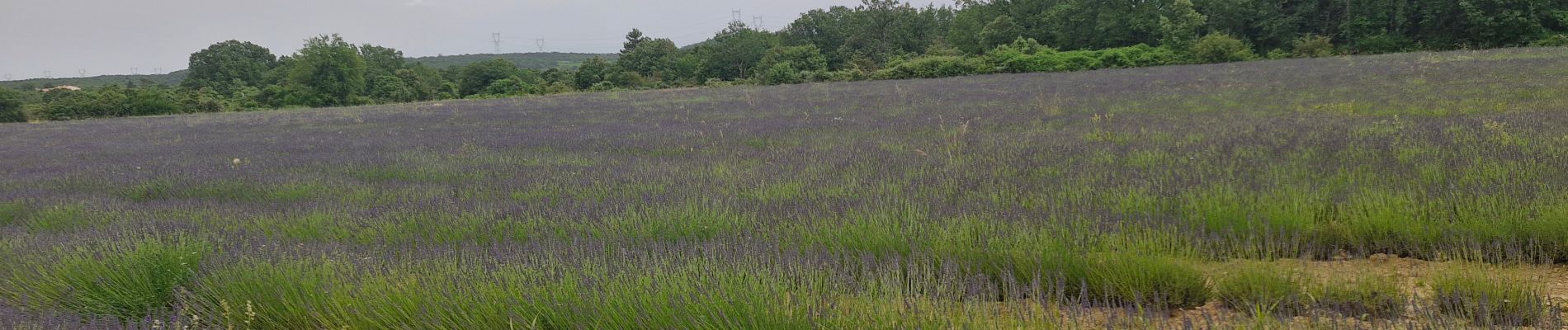
Larnas 6km.

chancha
User GUIDE
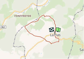

Length
6.1 km

Max alt
347 m

Uphill gradient
117 m
Km-Effort
7.7 km

Min alt
294 m

Downhill gradient
118 m
Boucle
Yes
Creation date :
2024-06-19 12:50:52.364
Updated on :
2024-06-25 05:40:21.181
1h44
Difficulty : Medium

FREE GPS app for hiking
 SityTrail
IGN / Geographical institutes
SityTrail Plus
The world is yours!
About
Trail Walking of 6.1 km to be discovered at Auvergne-Rhône-Alpes, Ardèche, Larnas. This trail is proposed by chancha.
Photos

Positioning
Country:
France
Region :
Auvergne-Rhône-Alpes
Department/Province :
Ardèche
Municipality :
Larnas
Location:
Unknown
Start:(Dec)
Start:(UTM)
627182 ; 4922865 (31T) N.
Comments