


Giens

mthseeuws
User
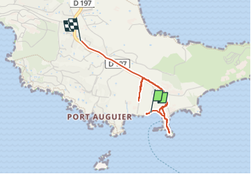

Length
3.4 km

Max alt
46 m

Uphill gradient
80 m
Km-Effort
4.4 km

Min alt
0 m

Downhill gradient
54 m
Boucle
No
Creation date :
2024-06-19 14:49:43.187
Updated on :
2024-06-19 15:52:30.179
53m
Difficulty : Easy

FREE GPS app for hiking
 SityTrail
IGN / Geographical institutes
SityTrail Plus
The world is yours!
About
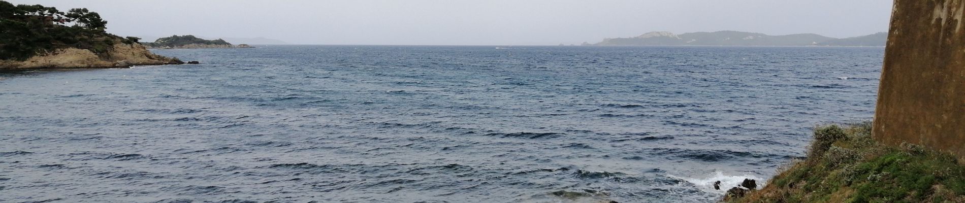
Trail Walking of 3.4 km to be discovered at Provence-Alpes-Côte d'Azur, Var, Hyères. This trail is proposed by mthseeuws.
Photos


Positioning
Country:
France
Region :
Provence-Alpes-Côte d'Azur
Department/Province :
Var
Municipality :
Hyères
Location:
Unknown
Start:(Dec)
Start:(UTM)
268067 ; 4767892 (32T) N.
Comments