


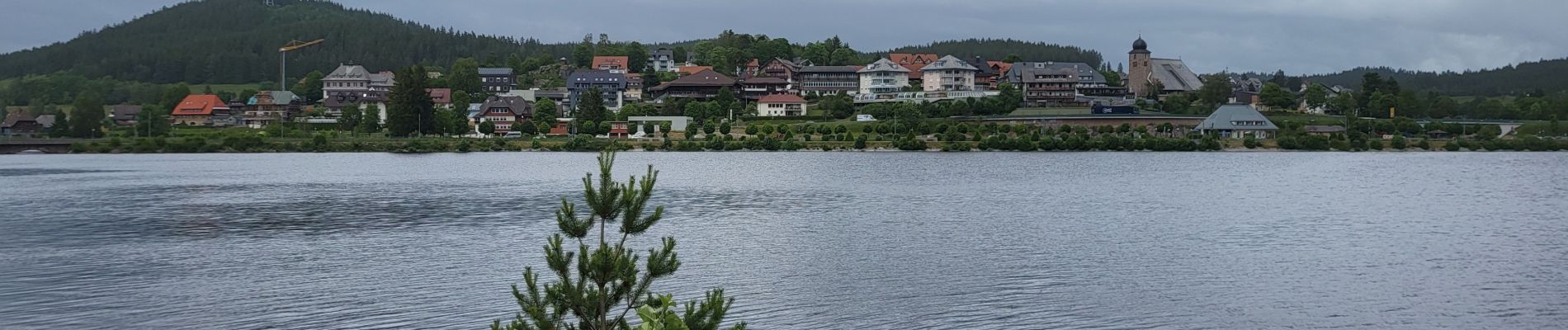
Forêt Noire : tour du lac Schluchsee

Bart2015
User
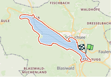

Length
17.7 km

Max alt
965 m

Uphill gradient
265 m
Km-Effort
21 km

Min alt
906 m

Downhill gradient
265 m
Boucle
Yes
Creation date :
2024-06-20 08:53:01.798
Updated on :
2024-06-22 08:37:21.009
4h49
Difficulty : Very difficult

FREE GPS app for hiking
 SityTrail
IGN / Geographical institutes
SityTrail Plus
The world is yours!
About
Trail Walking of 17.7 km to be discovered at Baden-Württemberg, Landkreis Breisgau-Hochschwarzwald, Schluchsee. This trail is proposed by Bart2015.
Photos


Positioning
Country:
Germany
Region :
Baden-Württemberg
Department/Province :
Landkreis Breisgau-Hochschwarzwald
Municipality :
Schluchsee
Location:
Faulenfürst-Seebrugg
Start:(Dec)
Start:(UTM)
439290 ; 5295048 (32T) N.
Comments