


Lac de Juclar 2024-06-22

Nordic33
User GUIDE
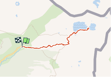

Length
9 km

Max alt
2333 m

Uphill gradient
533 m
Km-Effort
16.1 km

Min alt
1832 m

Downhill gradient
532 m
Boucle
Yes
Creation date :
2024-06-22 06:53:01.176
Updated on :
2024-07-12 16:27:23.24
7h45
Difficulty : Difficult

FREE GPS app for hiking
 SityTrail
IGN / Geographical institutes
SityTrail Plus
The world is yours!
About
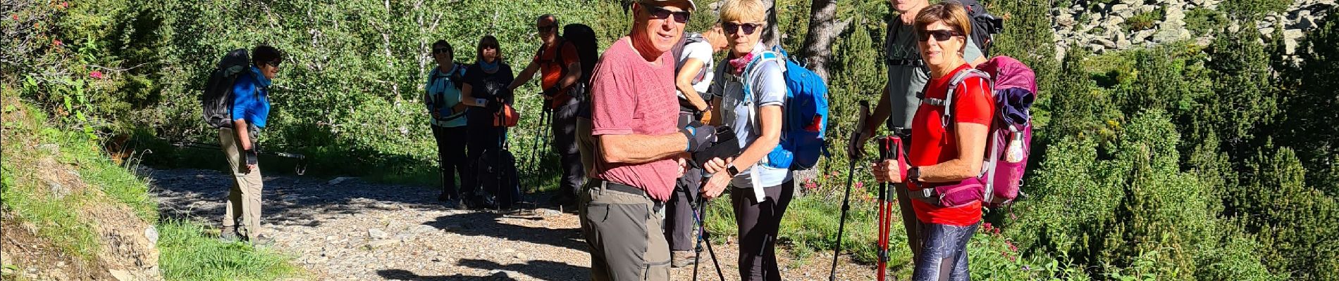
Trail Walking of 9 km to be discovered at Andorra. This trail is proposed by Nordic33.
Photos


Positioning
Country:
Andorra
Region :
Unknown
Department/Province :
Unknown
Municipality :
Unknown
Location:
Unknown
Start:(Dec)
Start:(UTM)
392233 ; 4717402 (31T) N.
Comments