


Stadbredimus L2L

chgarit
User
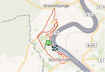

Length
10.8 km

Max alt
225 m

Uphill gradient
154 m
Km-Effort
13.1 km

Min alt
135 m

Downhill gradient
223 m
Boucle
No
Creation date :
2024-06-22 13:35:41.0
Updated on :
2024-06-22 16:07:56.064
1h41
Difficulty :

FREE GPS app for hiking
 SityTrail
IGN / Geographical institutes
SityTrail Plus
The world is yours!
About
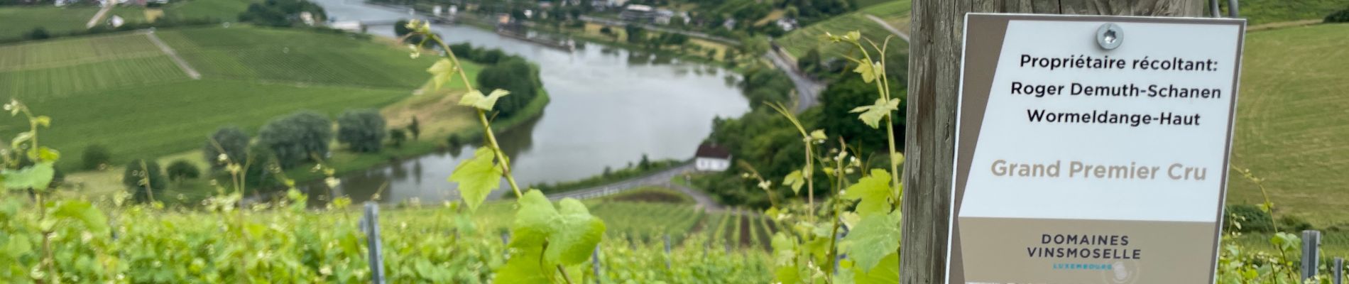
Trail Walking of 10.8 km to be discovered at Unknown, Canton Remich, Stadtbredimus. This trail is proposed by chgarit.
Photos


Positioning
Country:
Luxembourg
Region :
Unknown
Department/Province :
Canton Remich
Municipality :
Stadtbredimus
Location:
Unknown
Start:(Dec)
Start:(UTM)
308609 ; 5494089 (32U) N.
Comments