


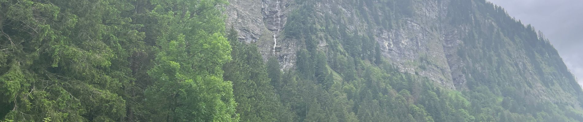
Lac de Montrion, cascade d’Argent

daniel34
User
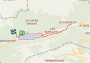

Length
7.5 km

Max alt
1214 m

Uphill gradient
237 m
Km-Effort
10.6 km

Min alt
1065 m

Downhill gradient
237 m
Boucle
Yes
Creation date :
2024-06-23 12:24:31.0
Updated on :
2024-06-23 15:03:39.249
1h57
Difficulty : Easy

FREE GPS app for hiking
 SityTrail
IGN / Geographical institutes
SityTrail Plus
The world is yours!
About
Trail Walking of 7.5 km to be discovered at Auvergne-Rhône-Alpes, Upper Savoy, Montriond. This trail is proposed by daniel34.
Description
Belle petite rando
Photos


Positioning
Country:
France
Region :
Auvergne-Rhône-Alpes
Department/Province :
Upper Savoy
Municipality :
Montriond
Location:
Unknown
Start:(Dec)
Start:(UTM)
324162 ; 5119680 (32T) N.
Comments