


aulus

bouscaillou
User
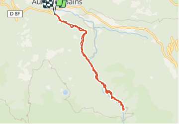

Length
10.9 km

Max alt
1310 m

Uphill gradient
617 m
Km-Effort
19.2 km

Min alt
770 m

Downhill gradient
619 m
Boucle
Yes
Creation date :
2024-06-26 07:08:17.878
Updated on :
2024-06-26 10:54:28.808
3h43
Difficulty : Very difficult

FREE GPS app for hiking
 SityTrail
IGN / Geographical institutes
SityTrail Plus
The world is yours!
About
Trail Walking of 10.9 km to be discovered at Occitania, Ariège, Aulus-les-Bains. This trail is proposed by bouscaillou.
Positioning
Country:
France
Region :
Occitania
Department/Province :
Ariège
Municipality :
Aulus-les-Bains
Location:
Unknown
Start:(Dec)
Start:(UTM)
364101 ; 4738562 (31T) N.
Comments