


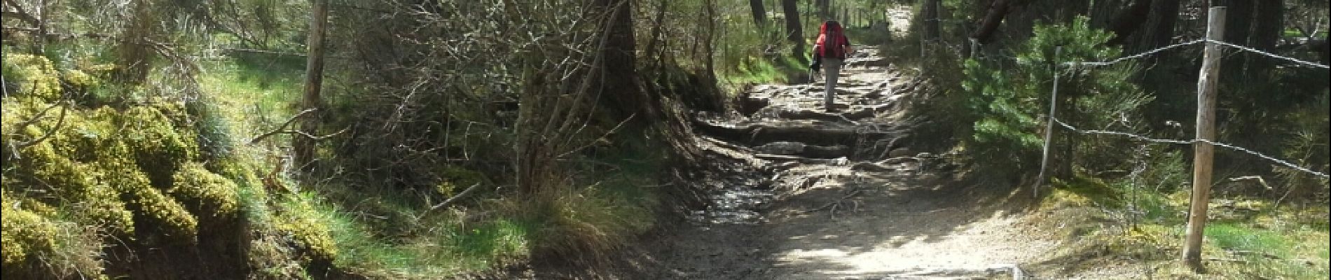
Le Sauvage - Aumont-Aubrac

RR31
User
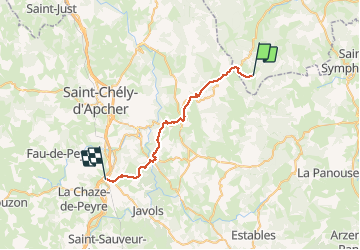

Length
31 km

Max alt
1333 m

Uphill gradient
574 m
Km-Effort
39 km

Min alt
918 m

Downhill gradient
818 m
Boucle
No
Creation date :
2015-04-20 00:00:00.0
Updated on :
2015-04-20 00:00:00.0
8h44
Difficulty : Very difficult

FREE GPS app for hiking
 SityTrail
IGN / Geographical institutes
SityTrail Plus
The world is yours!
About
Trail Walking of 31 km to be discovered at Auvergne-Rhône-Alpes, Haute-Loire, Chanaleilles. This trail is proposed by RR31.
Description
Saint Jacques
Photos


Positioning
Country:
France
Region :
Auvergne-Rhône-Alpes
Department/Province :
Haute-Loire
Municipality :
Chanaleilles
Location:
Unknown
Start:(Dec)
Start:(UTM)
538500 ; 4963535 (31T) N.
Comments