


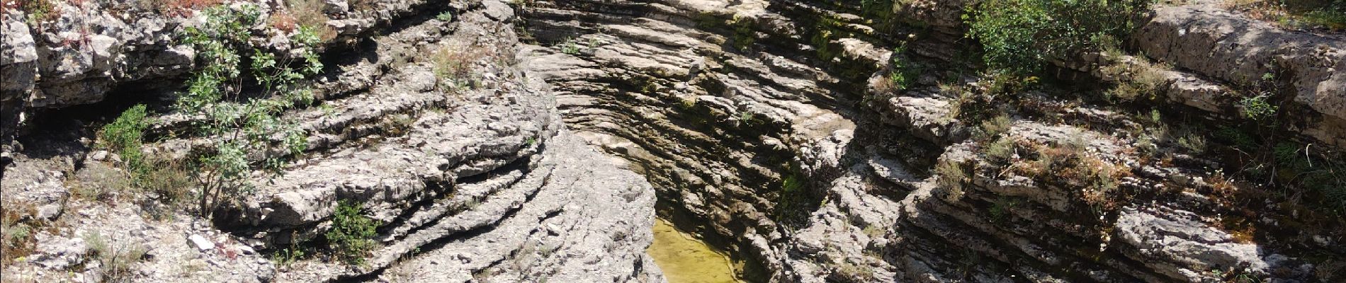
canyon de la Louyre

cousam
User
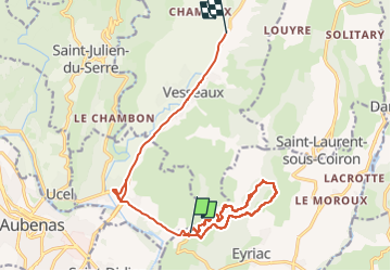

Length
17.8 km

Max alt
363 m

Uphill gradient
346 m
Km-Effort
22 km

Min alt
190 m

Downhill gradient
258 m
Boucle
No
Creation date :
2024-06-27 07:16:09.732
Updated on :
2024-06-28 13:42:56.633
6h07
Difficulty : Very difficult

FREE GPS app for hiking
 SityTrail
IGN / Geographical institutes
SityTrail Plus
The world is yours!
About
Trail Walking of 17.8 km to be discovered at Auvergne-Rhône-Alpes, Ardèche, Lussas. This trail is proposed by cousam.
Photos


Positioning
Country:
France
Region :
Auvergne-Rhône-Alpes
Department/Province :
Ardèche
Municipality :
Lussas
Location:
Unknown
Start:(Dec)
Start:(UTM)
614289 ; 4941606 (31T) N.
Comments