


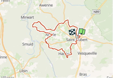
MESA ST HUBERT 32 km

Alain Williaume
User

Length
29 km

Max alt
548 m

Uphill gradient
667 m
Km-Effort
38 km

Min alt
330 m

Downhill gradient
670 m
Boucle
Yes
Creation date :
2024-06-27 05:33:18.0
Updated on :
2024-06-28 17:51:02.919
5h23
Difficulty : Easy

FREE GPS app for hiking
 SityTrail
IGN / Geographical institutes
SityTrail Plus
The world is yours!
About
Trail Walking of 29 km to be discovered at Wallonia, Luxembourg, Saint-Hubert. This trail is proposed by Alain Williaume.
Positioning
Country:
Belgium
Region :
Wallonia
Department/Province :
Luxembourg
Municipality :
Saint-Hubert
Location:
Unknown
Start:(Dec)
Start:(UTM)
670163 ; 5544284 (31U) N.
Comments